|
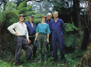
The Group
The Friends of the Trestle Bridge is a volunteer non-profit group committed to caring for the Monbulk Creek and lower Clematis
Creek Valley environment and habitat and the area surrounding and associated with the historic 1900 vintage Puffing Billy
Railway Trestle Bridge
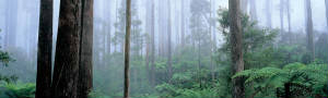
This location was recently incorporated into the Sherbrooke Forest Unit of the Dandenong Ranges National Park
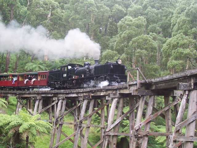
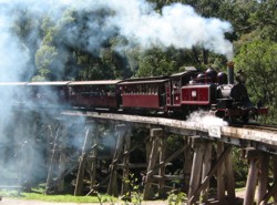
The bridge, situated at Selby in The Dandenong Ranges, some 26.5 miles by rail east Of Melbourne, carries the Puffing
Billy Heritage Narrow-Gauge (2'6") Railway over the Monbulk Creek and is part of a working railway that now carries considerably
more traffic than in it's prime working era of the first 30 years of the 20th century
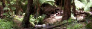
The Watercourse
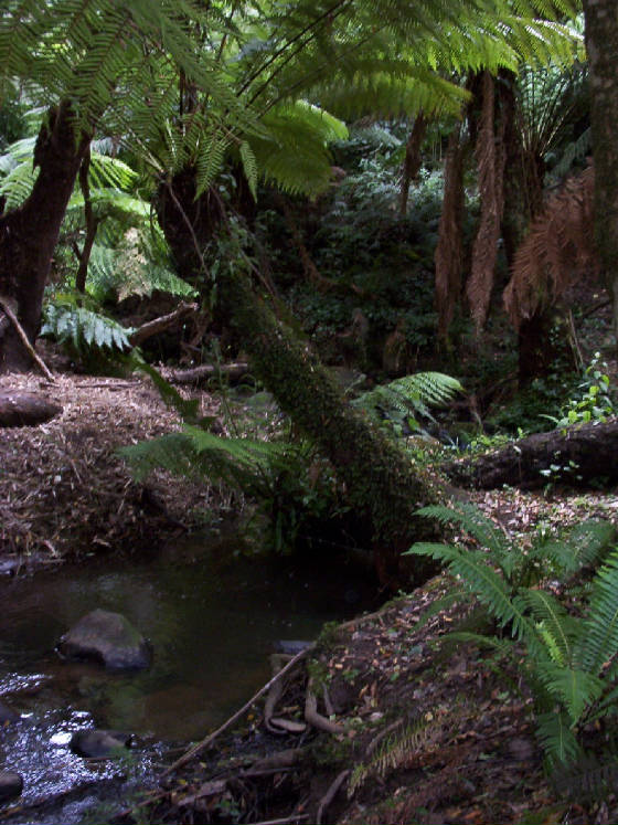
The Monbulk Creek rises in the Eastern Sherbrooke Forest and after joining with, firstly Hardy's creek, then the Clematis
Creek, which drains the Western Sherbrooke Forest, at a confluence about 100 metres downstream of the bridge
It then passes through the old Dandenong Reservior (which clarifies the water) 1km away below Belgrave, then through the
extensive Bird's Land retarding basins, 3kms (as the crow flies) from the bridge and continues west through the Lysterfield
Valley to Stud Road
Bird's Land is named for the long-time family farm that became the Monbulk Creek Retarding Basin
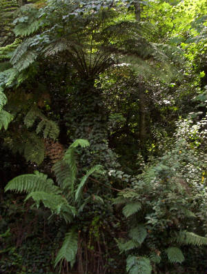
Despite it's origin in the depths of the forest, by the time the creek flows under the bridge it is not pristine, due
to the private property and roads drainage sharing the catchment upstream from the bridge
The 3 main tributaries, rising just below Grantulla Road, are surrounded by private land, some of it agricultural
This creek system is reputed to have the largest population density of the reclusive Platypus in the Melbourne watershed,
although they have only been counted in waters well below the bridge, much less clean and vegetated and running through established
medium density housing, mostly with private garden frontages all the way to Bird's Land
It may be reasonable to assume that there are even more upstream in the forest past the bridge
It's also a home for native fishes, yabbies, including big red freshwater crays and other invertibrates
The Friends are aware of a report of a six-pound brown trout caught in a Bird's Land basin lake and these lakes also were
stocked with exotic roach, redfin and support native short-finned eels and river blackfish as does the rest of the creek upstream
The History
The name is a version of the aboriginal term for this western reach of the Great Divide, Monbolloc meaning, literally, a hiding
place in the hills, a sanctuary, as it was the place for the different tribal groups from Gippsland, Marysville and bayside
coastal areas to meet, travelling to and from under a sacred peace
The Nathania Springs location above Monbulk was an aboriginal convalescent resort for the ill and injured
The present town of Monbulk is on the site of the meeting place but actually is over the ridge in the Yarra Valley watershed.
The name applied to the whole forest
The creek's name changes to the Corhanwarrabul Creek after it combines with the Ferny Creek near Rowville
The name changes at Rowville because at Lysterfield, the creek once used to disappear into an extensive, impenetrable
ti-tree wetland (long since drained, some of the channel by local aboriginal labour in the 1870's and only recently built
upon) that extended to Stud Road. The Lysterfield valley floor is rich volcanic peaty silt and has seen much market garden
activity and even a turf farm. The watercourse draining this wetland was given a different name
It then joins the Dandenong Creek 200m north of Wellington Road, flows through the Tirhatuan Wetlands, then becomes a
concrete drain through Dandenong. This creek was once sustenance for the vast Carrum Carrum wetlands but now most of it flows
into the man-made Patterson River drainage system before eventually discharging into Port Philip Bay at Carrum. The Mordialloc
Creek was once the northern outlet for the Carrum swamp and is now fed by a diversion from the Dandenong Creek. The small
southern remnant of this great swamp, the Seaford-Edithvale Wetlands, is protected under the international RAMSAR Convention
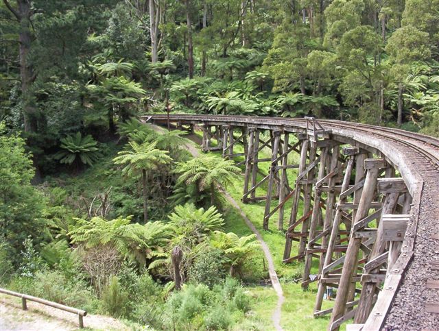
The Bridge
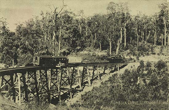
Trestle bridges are technically beam bridges supported by piers. This bridge, known as Bridge Five as it's the fifth bridge
from the Fern Tree Gully terminus, is constructed around a 3-chain** 10 mile-an-hour curve, the tightest curve radius on the
original Gembrook railway***
It's a good 300 ft long and consists of 14 timber piers between north/south situated abutments, and forms part of the
centre leg of the s-curve formation that the east-west railway must adopt to cross an east-west creek and carries trains around
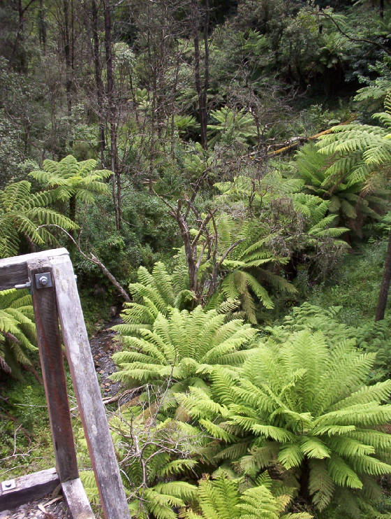
50 feet above the picturesque, treefern-lined Monbulk Creek.
It also serves to carry the little train 17 feet above the main Belgrave-Gembrook Road
The original main road/rail crossing was a level-crossing at the south (down) end of the trestle bridge
The bridge was constructed in 1899, but like granddad's axe which has had 12 new handles and 2 new heads, there may not
be many original members on the bridge. The poles and cross-members of the trestles are replaced as needed, poles often lasting
40 years and more. It was originally constructed from timber close to the site as was the practice
Newer poles are tallow wood (Eucalyptus microcorys from Qld.), used for its high eucalyptus and citronella oil content,
resisting rot and insects, giving it longevity when buried in waterlogged ground
It's an indication of the economic reasons for building narrow-gauge rail, with it's short-wheelbase derived ablity to
negotiate tight curves to follow contours around gullies in hill country, that there are only three more trestle bridges (all
recently re-constructed and one of the same radius curve and slightly higher than the Selby bridge) between this bridge and
the re-opened terminus at Gembrook.
The original plan was to one day upgrade to broad (5'3") gauge all the way to Emerald, and the Permanent Way land
incorporates some of the Muddy Creek gully below the old Tanks/Landslide site, a gully that the little trains can skirt around,
and was reserved for a future broad gauge bridge crossing to avoid the horseshoe bend
Also known as the Selby Trestle Bridge and in early days as the Monbulk Horseshoe Bridge, it sees train traffic 364 days
(and many nights) of the year and is an iconic and much photographed feature of Victoria's second most popular tourist attraction
after the little penguins
Puffing Billy is the second most popular steam heritage railway in the world
The bridge carries up to six trains a day in each direction carrying 250,000 passengers from all over the world every
year
The Task
Three quarters of the gully to the West of the bridge and up the Clematis Creek valley back to the Puffing Billy station is
National Park, Railway Right-Of-Way or reserve
This whole area suffers heavy infestation with a broad range of extremely invasive garden-escapee environmental weed species
including Sycamore Maple, Holly, Pittosporum, Tree Tobacco, Portugal Laurel, Cherry Laurel, Lilly-Pilly ssp., Buddlea, Bamboo,
Cestrum, Privet, English Ash, Desert Ash, Hypericum, Plectranthus, Ranunculus, Dombeya, Blackberry, Japanese Honeysuckle,
Himalayan Honetsuckle, Banana Passionfruit, Indian Strawberry, Arum Lily, Tradescantia and English Ivy, all at all stages
of development through to mature trees
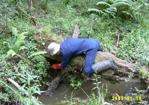
It's a good place to observe the worst of what these particularly tenacious weeds can do to a native forest as well as
what has already been achieved by the volunteer's efforts
With patient regular attention, many little and some larger victories have and are being won and the general rule is,
if you get rid of the weeds, the bush comes back
Regarding asterisks*
* N.B. Photographs taken from the bridge that feature in this site were taken by a Puffing Billy volunteer and Friends member
from the little rail trolley NK3
It is illegal and indeed dangerous to walk over the bridge
The deck consists only of loose bluestone ballast and often-slippery sleepers and it's a long way down
Maintenance workers must not work on the bridge deck without a temporary safety fence or must be be tethered to the rail
by a safety harness
** All measurement is in imperial format on the Heritage Railway and we use the same system when referencing rail property
and structures e.g. the railway Right-Of-Way reserve, known as the Permanent Way is 2 chains (44 yards) wide
Not only that but the Up end is towards Melbourne and the Down end towards Gembrook and the Down side of the track is
the side on one's left when looking Down from Melbourne, which is the opposite to the actual lay-of-the-land of most of the
PerWay
The railway uses their Signals & Telegraph pole numbers to accurately locate points on the track
All emergency services have these number locations marked on their maps
The Victrorian Railways used track mileage measured from Melbourne to pinpoint track locations
For Metric conversion, click gently on these spectacles
*** The landslide deviation, just past the old Tanks site on the Muddy Creek gully that was constructed in 1962 by the CMF
& PBPS to by-pass the buried track and re-open the line, was laid inside the original curve alignment on the old stopping-place
loading stage and yard formation (and the old bullock access track to Monbulk that went via School Road, Jackson's Hill and
down the precipitous "Aunt Sally" into The Patch)
The re-alignment reduced parts of the curve to a 2-chain radius and until recently was a 5 mile-per-hour corner
The curve has lately been eased and now carries a 10 mph speed limit
Both the Moe to Walhalla and Colac to Crowes lines had 2-chain curves, about the limit of the 8-foot wheelbase of the
locos
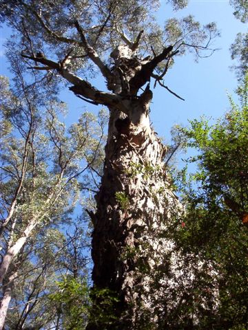
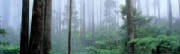
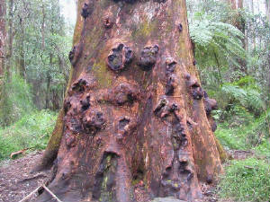
A big Old Man Mountain Grey Gum reposing in the afternoon sun
(Eucalyptus cypellacarpa)
Sherbrooke Forest
|
| Go to Parks Victoria's Dandenongs Page |
|